Sumac at the Quarry Lands

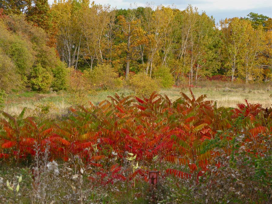
Fiery red staghorn sumac (Rhus typhina) brighten the Quarry Lands on a mild fall afternoon. © BCP 2010

I was planning on exploring Sun Valley today, but just plain ran out of time after doing all the things that absolutely had to be done. So, rather than not get in any walk at all, I decided to take a gander through the Quarry Lands, close to where I was doing my odd jobs. (For a map, click here.)

Good call! It was a lovely afternoon and for the first half hour or so I mostly had the huge acreage (49 acres, actually, according to the City of Toronto’s planning information) to myself. Then the dog walkers came out to enjoy the late afternoon, and I had a bit more company.

It has probably been a month since I last walked these lands and in that time much has happened. The thousands of spiders and their webs that I saw then have all disappeared, the dragonflies are long gone, and the riot of flowers in the meadow has been tamped down. The colours throughout the field now are generally more subdued, but there remain bursts of colour here and there.

The best colour today? Undoubtedly the staghorn sumacs (Rhus typhina), arising in small stands throughout the meadow. Absolutely stunning in their intense scarlet and gold hues.

Albert Camus said “Autumn is a second spring when every leaf is a flower.

I wonder if he was thinking about sumac when he wrote that.

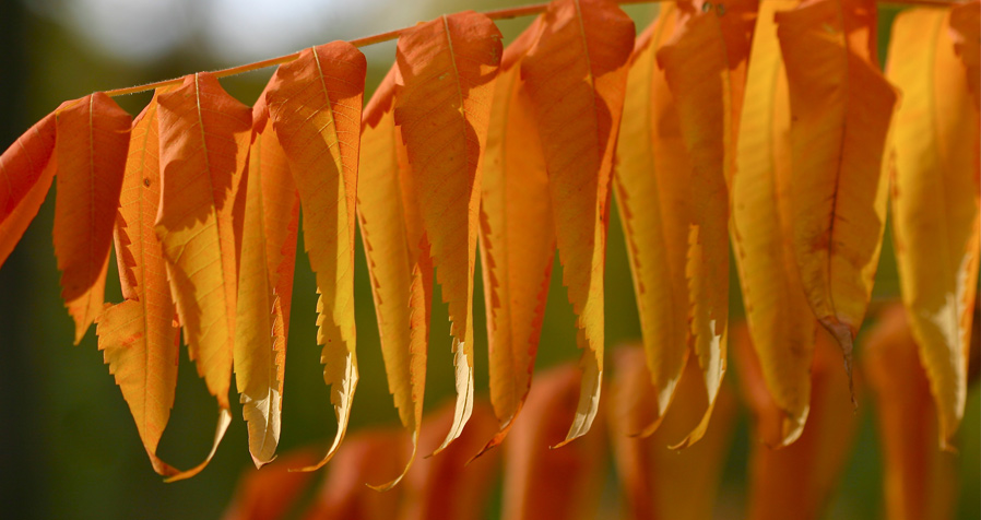
The leaves of the staghorn sumac glow in the late afternoon light at the Quarry. © BCP 2010

© BCP 2010

Labrador Lake, dressed in its fall finery

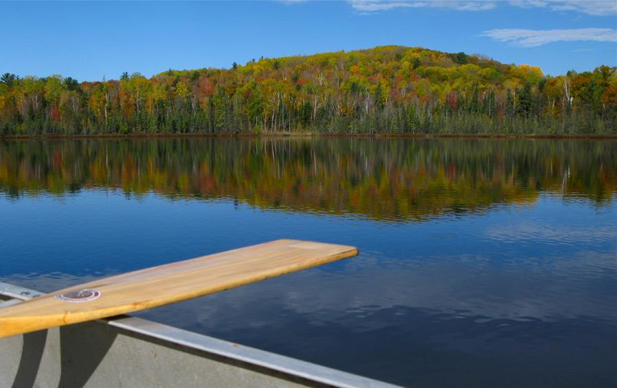
Labrador Lake in the Madawaska Valley dressed for the fall parade of colours. © BCP 2010

I think this might be the last picture I post this fall from my autumn leaf-peeping excursions to our near north. Soon I’ll get back to posting pictures of my fall rambles around our city, looking for the wild things we sometimes ignore.

This photo was taken about 10 days ago at the height of the fall colour change in the Madawaska Valley. To get it, I took a borrowed canoe and paddled the short distance through Green Lake — a tiny blip on topographic maps near Lake Kaminiskeg — over to the narrows that lead into Labrador Lake. Then I paddled around the entire circumference of the almost completely circular tiny lake. The sun was shining brilliantly, as you can see, bringing out the intensity of the colours.

Now, as I sit at home at my computer here in the Big Smoke, out my window I can see the leaves falling like rain in my yard. A gust of wind comes, and they dance in a private pageant put on for their boss, Ma Nature.

It couldn’t be more bitter sweet.

© BCP 2010

Madawaska moments

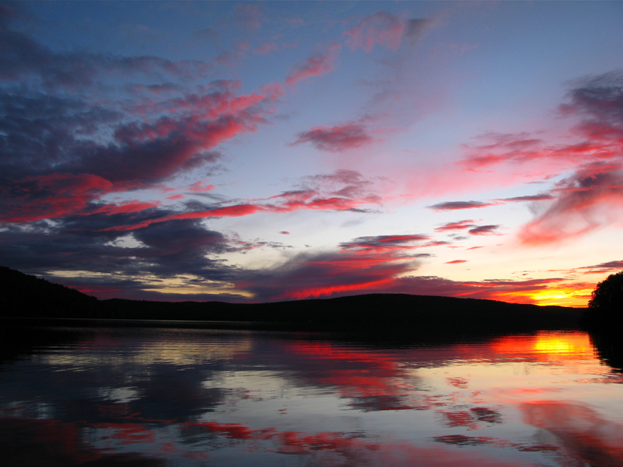
A brilliant autumn sunset over Lake Kaminiskeg in the Madawaska Valley. © BCP 2010

Our all-too-brief sojourn in the near north took us to Algonquin Park, as readers will have seen in my last two posts. But we put the miles on our car, getting to the park the long way — by going via the Madawaska Valley, first. We were blessed with the perfect weather for leaf peeping, as it turned out. And perfect for sunsets.

I wandered down to the lake just at sunset on our first night — Ack! The sun is setting so, so early now! — just in time to catch what I call the pink flash. I’ve been watching sunsets on this lake in the Madawaska for a long, long time. And in my experience, the pink flash is relatively rare. You can see it a bit, in the top photo.

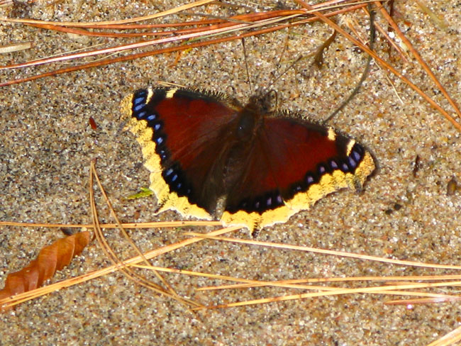
A mourning cloak butterfly (Nymphalis antiopa) settles on the sand, surrounded by white pine and red pine needles. © BCP 2010

The next day, I wandered down to the beach to see what I could see, and luck favoured me with a beautiful butterfly that fluttered by. It was a mourning cloak (Nymphalis antiopa), and I got a good long look at it as it stopped to nectar on the flowers growing along the water’s edge — mostly New England asters (purple) and bushy asters (white), I think.

Then the mourning cloak settled down on the warm sand and stayed there for quite a while. It was drawing warmth from the sand, giving it energy. Wings like jewels, right there before me. Another unforgettable moment in the Madawaska.

© BCP 2010

Autumn Afternoon in Algonquin, Part II

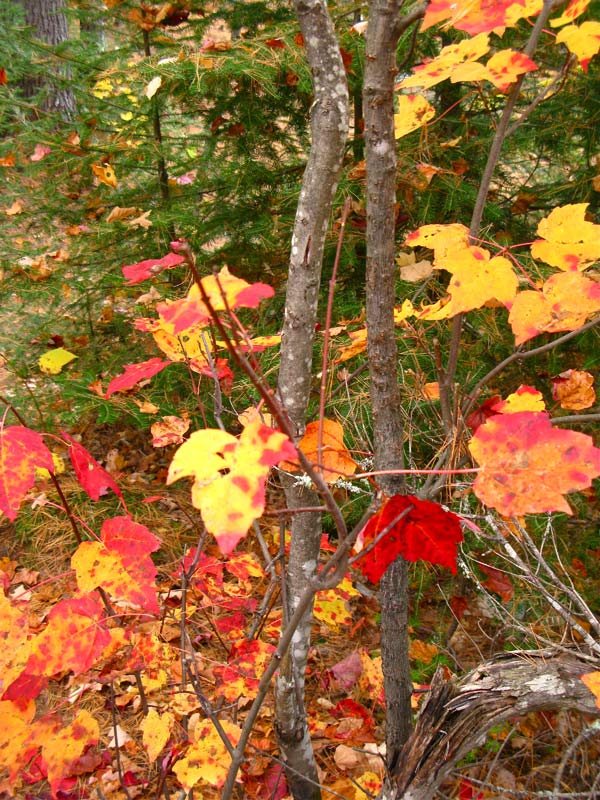
Maple leaves along the Lookout Trail in Algonquin Park. © BCP 2010

In my previous post, I wrote about several of our hikes in Algonquin Park last week. I took lots of pictures, a few of which I posted in my last entry.

I shot mostly sections of the trails, and the vistas from the lookouts. But my trusty hiking companion stopped me along a section of the Lookout Trail, and asked to borrow my little point and shoot Canon. He said he wanted to capture his “Tom Thomson moment.”

I looked up a couple of Thomson’s paintings and by gum, the leaves at left certainly evoke the spirit and mood of his paintings, at least IMHO.

I would have copied and pasted a sample of Thomson’s art, but then I would have been in violation of copyright…So you’ll have to go and look at them yourselves!

Clicking on this link will take you to some thumbnails of the famous painter’s work in Google images.

© BCP 2010

Autumn afternoon, Algonquin Park

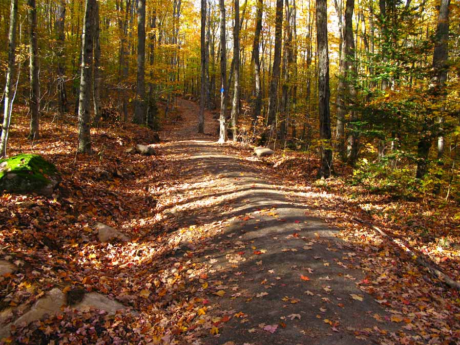
We stopped to grab a few photos on our way to the top of the Lookout Trail in Algonquin Park. © BCP 2010

Indian summer? It sure felt like it this past week in Algonquin Park, where we were blessed with perfect conditions for some fall hikes on the trails along the Highway 60 corridor.

We did several trails in the park over a few days, starting with the Spruce Bog Trail, which we hadn’t done for years. It was easy and flat — the trail guide went so far as to call it wheelchair accessible, something of a rarity in Algonquin Park where the Canadian Shield usually makes the terrain rocky and often steep. The Spruce Bog Boardwalk trail, at Km 42.5 on Highway 60, is an easy 1.5 km loop that took us aroud the Sunday Creek Bog, and the nearly perfectly round Kettle Bog. The trail guide helped with a thorough explanation of spruce bog ecology.

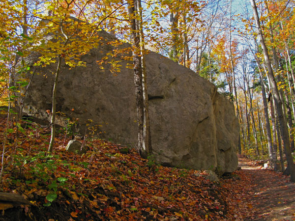
A glacial erratic along the Lookout Trail. Seriously huge, seriously impressive. © BCP 2010

The Spruce Bog Boardwalk just whetted our appetite, and as the afternoon was absolutely perfect — sunny, clear and just the right temperature for a hike — we decided to do another trail. Soon we were on our way to the  Lookout Trail, at km 39.7

We had never been on this particular trail before, and found it to be steep and rugged, just as billed.

Along the well-marked trail,  a 2.1 km loop that climbs through a young forest to the top of a high cliff, there were many points of interest, including massive glacial erratics, giant “pebbles” left behind when the vast glaciers that covered the area retreated about 11,000 years ago. The guide discusses the predominant trees  — white pine and sugar maple — seen along the trail.

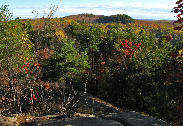
A view from the top looking across to one of the highest elevations in Algonquin. © BCP 2010

Once we arrived at the top of the hill, there was a spectacular payoff, with a view that seemed to go for miles and miles. In the photo to the left, you can see what the guide calls the cliff brow far in the distance. Its elevation is 1,850 ft. above sea level, making it one of the highest point in Algonquin Park.

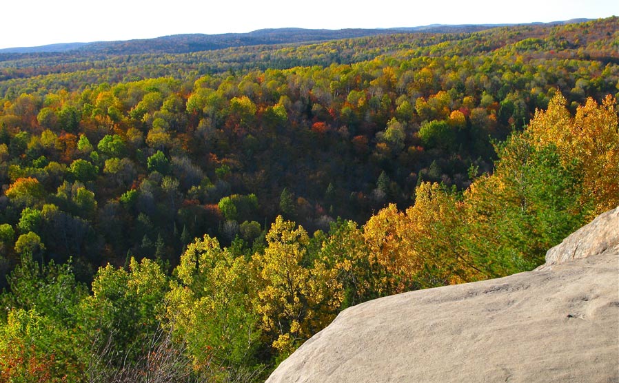
The trail continues along the top of the cliff for about 100 metres, offering other panoramic views. Did I mention that it was a very steep cliff? The guide says the following: “Children and pets should be kept under control at all times. Proceed with caution!” (If only it were that easy.)

You can get an idea of the cliff’s steepness in the photo below.

All in all, the Lookout Trail was the perfect choice for a perfect autumn day in Algonquin.

A view in a different direction from the top of the Lookout Trail, showing the precipitous cliff. © BCP 2010

M o r e   i n f o